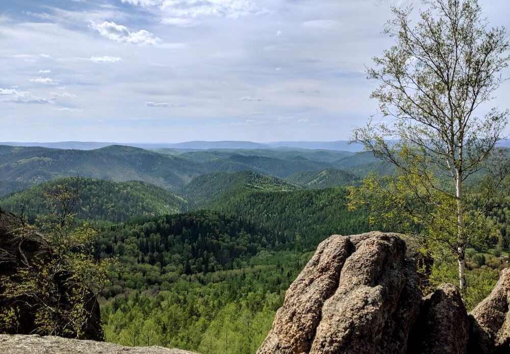
If you’re interested in hiking or getting outdoors during your time on the Trans-Siberian, then chances are you’ve already come across the photos of incredible views waiting for you at Stolby Nature Reserve. And I can confirm: they are every bit as good as they look. In fact, hiking Stolby Nature Reserve was one of the highlights of my journey across Russia.
Stolby Nature Reserve is basically Siberia 101. Do not miss it!
I knew that I wanted to get outdoors in Siberia, so Stolby Nature Park was one of the first stops I added to my my Trans-Siberian trip. And the good news is, getting there from Krasnoyarsk city centre could not be easier. And better still, navigating the hiking trails is simple.
Check out my full Trans-Siberian itinerary here.
Stolby Nature Reserve 101: what are Stolby?
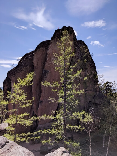
The Feathers – the best known of the Stolby
In Russian, ‘stolby’ literally means ‘pillars’ and is the term used to refer generically to all rock formations in the park, which jut dramatically out of the ground. The park itself is thickly forested (and feels a world away from heavily-urbanised Krasnoyarsk) and so despite their size, the stolby are still really well-hidden, seeming to just pop out of the ground unannounced.
To distinguish between them, seemingly all of them have been given individual (and hilarious) names. Like constellations, I have absolutely no idea how the formations are meant to resemble anything close to their namesakes – one is called ‘the Mittens’, for example. The park has plenty of signposts leading the way to the different formations, referring to them all by name. (All these names are marked on MAPS.ME btw – see below).
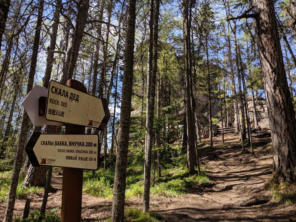
Signposts show the rock formations by name in Russian, English and Chinese
The main appeal of the Stolby is climbing them. Some can be scrambled up quite easily (even by those terrified of heights – like me), but some need some more specialist gear and you’re likely to come across a variety of climbers giving it a go. The stolby are located on a giant hill, so some of the most popular stolby are famous simply for the amazing views they offer.
The most famous of all are the Feathers, one of the largest and most dramatic stolby. The rock seems to erupt abruptly and vertically out of the ground, reaching a height which means they are visible all the way from the river back in the centre of Krasnoyarsk. Directly opposite it is The Lion’s Gate which is very easy to scramble up for great views of Krasnoyarsk in the distance.
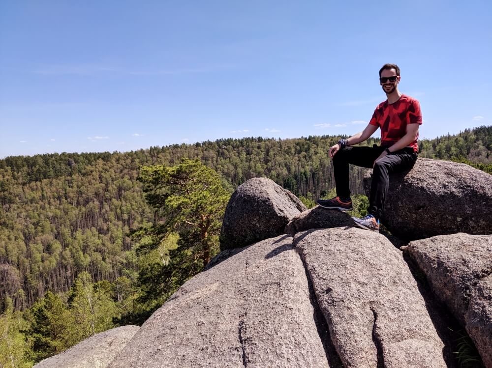
Proudly sitting atop The Lion’s Gate
Personally, I think the Grandfather offers the best views from his ‘shoulder’. This is the view that you’ll probably be most familiar with if you’ve done your research: rolling hills and thick green forest as far as the eye can see. This is exactly what I think of when I think of Siberia.
Getting to Stolby Nature Reserve from Krasnoyarsk
Stolby Nature Reserve is actually located within the city limits of Krasnoyarsk, but to optimise your time here, you’ll probably want to stay at least one night (probably two) to make sure you get a full day in the park.
From the centre of Krasnoyarsk, jump on the #50 bus (I got on at Glavpochtamt on ul. Lenina, which is the closest stop to Hovel Hostel) and ride it until the Turbaza stop. The journey takes about 40 minutes and will take you across the Yenisey river. Several other people are likely to alight at Turbaza in fitness and/or hiking gear (or at least armed with selfie sticks), so you’re unlikely to miss it.
As of June 2019, the price for a bus ride was 26 roubles each way. (As with all Russian buses, you buy the tickets in cash on board.)
More on things to do in Krasnoyarsk here.
Stolby Nature Reserve: hiking trails
The MAPS.ME app is crucial in Stolby Nature Reserve – all the Stolby are marked and it has trails that you will struggle to find otherwise.
At this point, it is crucial to point out how useful the MAPS.ME app is in the park. If you have it downloaded, your visit will be much more independent – you can simply follow the criss-crossing network of trails, choosing your route as you go.
Of course, even without the app (although I genuinely never go hiking in a foreign country without it), the park has several well-planned-out options for exploring the park and the beautiful rock formations. These trails take the form of 5 colour-coded routes, which take in different rock formations and cover different distances. I didn’t walk any of these routes, but did come across them while hiking.
The best views at the Stolby Nature Reserve: in my mind the best views are from either the ‘shoulder’ of The Grandfather or from the ‘gap’ in the rock at the Watershed. Both look out over uninterrupted forest and rolling hills. For views of Krasnoyarsk, The Lion’s Gate is probably the best.
The geography of Stolby Nature Reserve: starting your hike
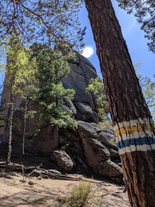
The colour-coded trails shown on a tree next to the Feathers
However, the main difference between using MAPS.ME and the official walking routes is that the latter all start at the central centre visitor entrance – which is almost the furthest point from the main road (and bus stop).
Think of it like starting from the very back: to reach the visitor centre, it’s a long, boring seven-kilometre slog uphill along a largely paved road. I finished my hiking at this point and walked back down to the road and it felt very long – an hour of downhill walking. I would not recommend starting at the visitor entrance.
Instead, I used MAPS.ME to plot a route, which veered off the main trail quite early on, leading me directly to the formations named Dikarek and Vnuk. (see below)
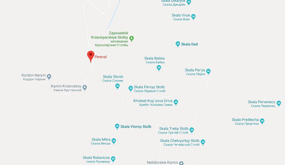
The largest concentration of Stolby – the ‘official’ entrance/exit is marked
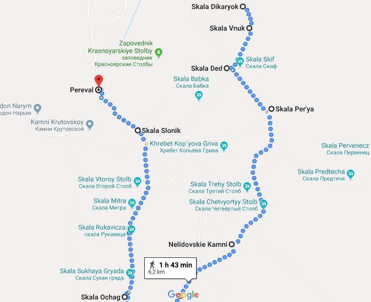
My route around the Stolby
My hiking route
After arriving at Turbaza, I took the nice gentle path on the left side of the river (the tarmacked road is on the right). The path is pretty unremarkable (and flat) for a long while before things get interesting. The path eventually meets up with the road at some point and both cross the river.
After about 6 kilometres, I took a path on the left marked on MAPS.ME towards Dikarek and Vnuk – the first two stolby closest to the main road. The path was not sign-posted from the road but was pretty well-trodden and cleared after a little while. The path crosses back over the river, before ascending a steep hill. I am fan of steep hills, so even though I was sweating buckets, it was still rewarding work. After around a kilometre, I came up on a clearing at Dikarek, having seen no-one else on the brief but intense climb.
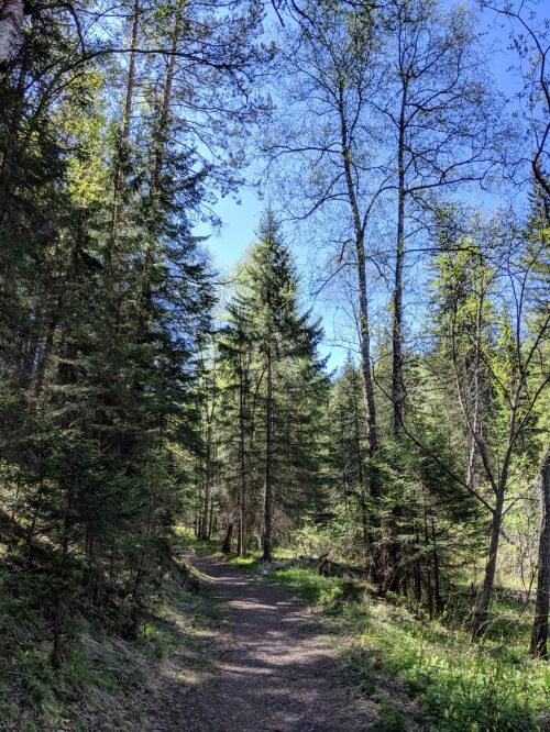
Easy going before tackling the hill
Dikarek had a picnic table, a small little cave that people had used for campfire but proved a bit too tricky to climb. Dikarek apparently means ‘savage’, which is an extreme name for a rather boring rock. Name: 7/10. Appeal: 3/10.
Just behind Dikarek was Vnuk, the Grandson. The Grandson was a bit more interesting and I managed to try some low-key climbing. The Grandson is built in two main sections, but I wasn’t able to climb from the first to the second, even though I could there would be nice views at the top. Still, good practice. Name: 4/10. Appeal: 6/10.
From the Grandson, I very quickly reached the Grandfather. Here, there’s a little bit of a plateau and a clearing. This is where a high concentration of the most popular formations is to be found and where a lot of the different hiking routes intersect. Having enjoyed a lot of solitude, here is where I suddenly came across a fair few other visitors.

Selfie from the ‘shoulder’ of The Grandfather
The Grandfather and the Feathers
The Grandfather is a very easy formation to scramble up – he has long, sloping rocks which allow you to clamber up fairly easily. His ‘shoulder’ is a large, smooth platform offering up some incredible views over the surrounding forests. Name: 4/10. Appeal: 10/10.
Situated conveniently just next to the Grandfather is the twin formations of the Feathers and the Lion’s Gate. The latter is also easily climbed for amazing views of Krasnoyarsk. It’s also the best way to take in the scale of the Feathers – the rocks really are gigantic and bizarrely vertical. It makes you wonder how they don’t just topple over. Name: 5/10. Appeal: 10/10.
Leaving via the Entrance
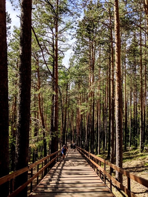
The official ‘entrance’ of the park
Having ticked off the two main stolby and being situated firmly on the high plateau of the park, I was free to have a gentle meander through the thick woods to discover some more formations. Using MAPS.ME as my guide, I decided to head to one of the furthest-lying formations, before circling back and heading home.
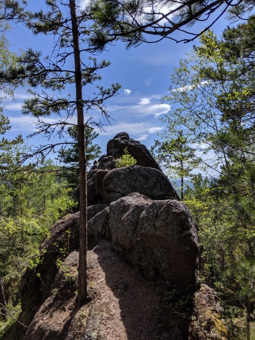
The Hearth
I walked via the Third Pillar and the Forth Pillar (both very unremarkable with even more unremarkable names – Names: 0/10. Appeal 0/10.) before lopping around to the Hearth. The Hearth I liked – it is a short but tall narrow ridge of rocks which protrudes gradually from the earth. It looks a lot like a dinosaur’s spine (which would have been a much cooler name) and it was easy enough to climb to about mid-way. Name: 2/10. Appeal: 7/10.
From the Heath, there is a vertical line with several named formations in a row, so I opted to tick these off as I walked along.
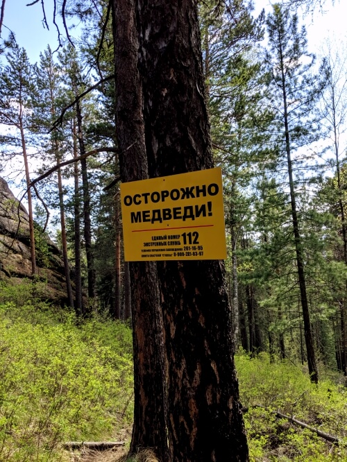
WARNING BEARS!
After not very long, I came across the most terrifying sign you can see whilst hiking. WARNING: BEARS! I let myself panic for a minute or two and then just carried on, trying to make a lot more noise than earlier to warn any bears of my presence. (SPOILER ALERT: I was not attacked by bears).
From here, I then visited the Watershed. Unlike the other formations, the Watershed is less like an individual formation and more like a solid wall of rock. It is quite easy to climb about half-way up and an opening gives you some more fantastic views. Thanks to its proximity to the entrance of the park, the Watershed seemed to be one of the most popular stolby and some Russian climbers offered to take my photo next to a very large, vertical drop. (I look awkward because I am trying not to die.) Name: 1/10. Appeal: 7/10.
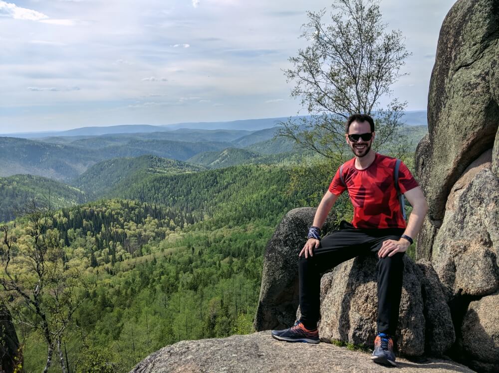
My awkward selfie
From here, I then walked to the Elephant (Name: 8/10. Appeal: 1/10.), located at the very entrance at the park, before going down approximately one thousand steps and then walking along the very long, boring trail back to the bus stop.
In total, I actually only covered around 20 kilometres over the course of 6 hours. Anyone with a better ability to climb would probably want to stay longer to try their hand (literally) at scaling some more of the rocks.
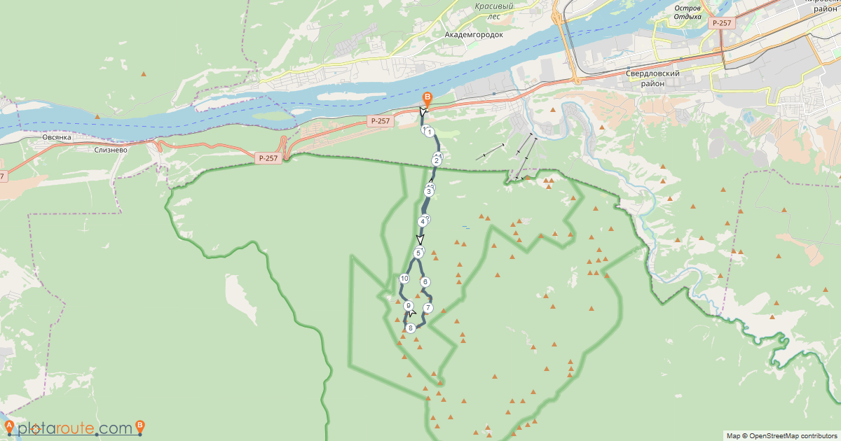
My hiking trail in Stolby Nature Reserve
Lasting impressions
There’s no way around it: Stolby Nature Reserve is a must on a Trans-Siberian journey.
I was fortunate to be hiking on such a beautiful day (it was 28 degrees and sunny during my time in Krasnoyarsk – a stark contrast to Lake Baikal just two days before) and the beautiful nature and far-reaching views left a lasting impression on me.
What was nice to see was how many locals seemed to be out enjoying the reserve – running, hiking, walking, rock climbing or taking endless selfies. Yet the park never felt busy – with the criss-cross of trails, you can easily find yourself on a remote route or a less-trodden trail and feel like the only person around.
If you’re even vaguely interested in hiking or the outdoors, go to Stolby Nature Reserve.
More on the Trans-Siberian:
Heading West:
Tomsk:
Is Tomsk worth visiting?
Yekaterinburg:
36 hours in Yekaterinburg
Heading East:
Lake Baikal:
Hiking the Great Baikal Trail
Lake Baikal in the off-season: visiting Listvyanka in May
Ulan-Ude:
23 hours in Ulan-Ude


It looks absolutely gorgeous and like you got super lucky with the weather. Although I probably wouldnt do any of the less-populated trails solo as a woman anywhere in Russia…
The weather was beautiful! Stolby was quite busy, I never went too long without seeing other visitors, but I guess you can never be too careful!